Here is the link to the final version of the Island Project, version 147!
https://www.dropbox.com/s/1s0hxsreortjkwj/Islands%20Low-147%20final.tmd?dl=0

Working on the Island project full time again, and released the a new video today for the Cartography Backers - World Machine Texturing Basics.
A series of videos are in the making mostly for Cartography Backers covering technical stuff. Upcoming videos are, WM Advanced Texturing, WM Export, Import data from WM into Photoshop. Project setup in Photoshop, Editing Techniques in Photoshop.
I will also make videos presenting the project in less technical manner for all backers as well. A few previews into the next project will come for Trailblazer and Cartography Backers will come soon as well.
The final Island Project World Machine file will be available for Cartography Backers very soon, as well as all the export data. So make sure to make room on your hard drives, it will be needed!
Again thank you all for your support 🙂
Here comes a video covering the basics of how to texture your terrain in World Machine.
I've spent the past two weeks working on a special Midgard project, which meant using both my computers I use for work. This meant the Island Project had to be put aside, for which I'm truly sorry. Work on the island Project is again full time and will so be until its release in the coming two weeks are complete.
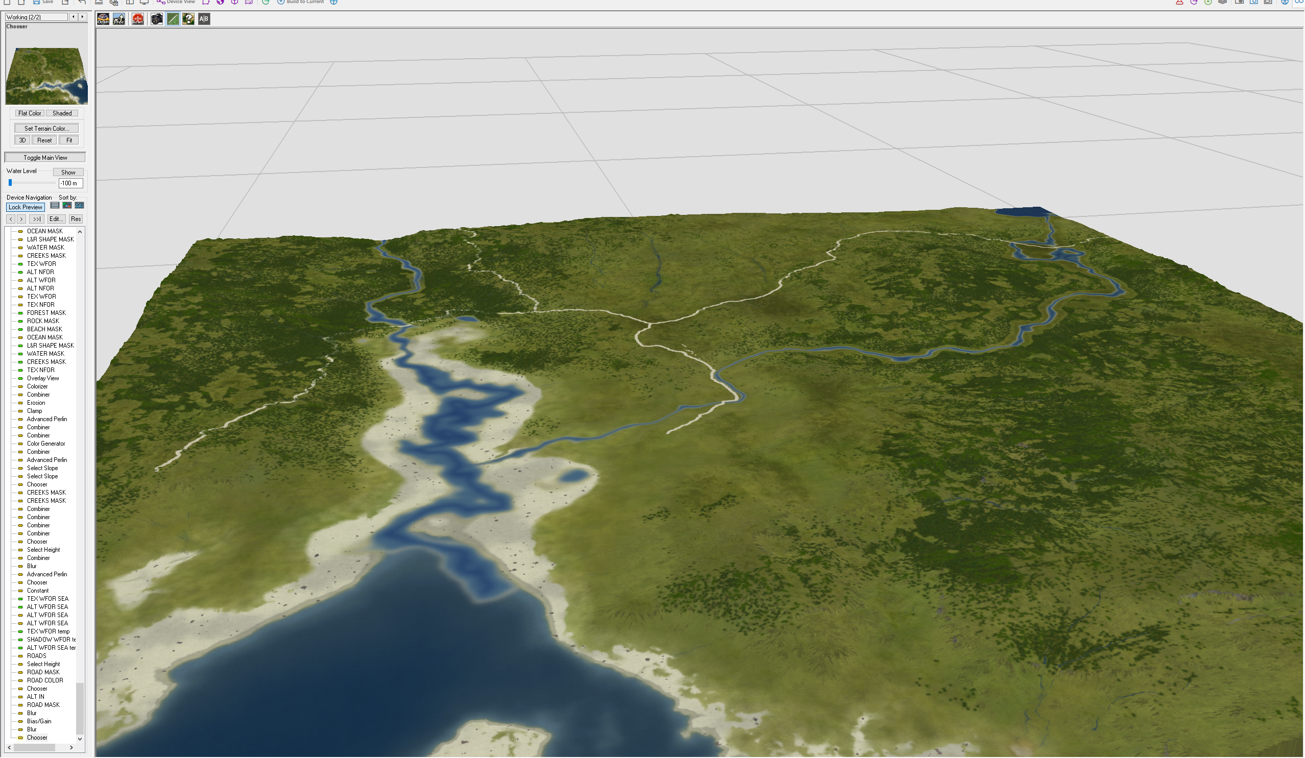
My work on Midgard have now superseded everything else I've done to date, both in scope and level of detail. This is a full 3D terrain larger than Europe and Africa combined, with a matching texture map that is the same as the one used for the top own map.
This is the first test of truly continental scale work, and a great preparation for projects to come!
You can find out more about Midgard here: https://www.facebook.com/MidgardCampaignSetting/
and Kobold Press also runs a Patreon so support their Midgard work:
https://www.patreon.com/koboldpress
A short little "progress"(!? :|) report, explaining why the islands project will not make it before the end of January.
Rendering it in World Machine takes time, almost 4 days most likely, so there will be no charge end of January. This is the main reason I'm having two powerful desktops, so I have one to work on while the is stuck in render land. World Machine is strangely attuned to 42%, but it is the universal answer so I guess it makes sense 🙂
I'm doing a lot of other useful mapping while this is slowly moving forward, but I'm still sorry for the delay.
The first poll is done and the results are in, thank you all for voting!
What places will make it onto the islands?
Hidden coves, with and without pirate hideouts seem to be of top interest, and from an adventure perspective it makes perfect sense 🙂
1. Hidden cove of pirates, 9 votes
2. Secret Cove, 8 votes
The coves are followed by a two of inland features:
3A. River Crossing with the Inn of lost Tales, 7 votes
3B. Fortress Refuge, 7 votes
The only "large" settlement that made it onto the list:
4. Small town of traders and boat builders, 6 votes
Two more inland features that I like from a cartography perspective, the lake shore look like its made to have a road.
5A. Lakeside Village, 4 votes
5B. River Crossing, 4 votes
These are my little darlings so I'm so pleased they made the list, and a place is not complete without a Druid Grove. The Hermit Monastery by Nerd Podcast Radio is my favorite by far and it made the list, I'm so happy for that.
6A. Plunge Cliff, 3 votes
6B. Druid Grove, 3 votes
6C. Hermit Monastery Brewery, for selected connoisseurs every century, 3
votes
Here is the description by Nerd Podcast Radio:
"A commune of tengu monks that worships an obscure god of distillation. They make the best Scotch in the world and only release a bottle to petitioners who pass a series of impossible tests. Only one bottle is released every 100 years"
The brewery is a must!
Time again for a blog post about what I'm up to for the moment and a look into what is on the horizon. First a huge thank you to all my Patreons who have decided to support me, it means a lot to me!

My second Patreon project - Islands, are moving into the final phase adding settlements, roads and other features of civilization. Which features will make it on the map will be decided by my my Patreons who have backed me at the Adventurer level or above. The results will be a set of seasonal islands mapped i exquisite detail, fully modeled in 3D. Perfect for adventures in need of an group of islands to explore. The poll close in 12 hours and at the moment the leading places are, hidden coves with and without pirate camps, the Inn of Lost Tales, Fortress Refuge and a small trading town.
I also keep a secret part of the list that will make it on for sure, that is a cartographers privilege, making sure my special favorite details make it on to the map. Delivery of the final maps will begin in about a weeks time after a final touch up. First the basic maps for all backers, followed by the advanced content that will take a little bit longer to create.

This is a busy time with a secret project for Kobold Project underway that I'm sure will please fans of Midgard. It will require me to dig deep into the toolbox and think big, really big. The results of this will if everything goes well play a part of launch of the new Midgard hardcover. It is also a first technology test for bringing old "flat maps" into the 3D realm, which will play a major role in a number of projects coming up.

Made an appearance a few days ago on Twitch Channel Return to Greyhawk run by DM Shane, you can see the interview here.
Next commission project coming up is the Curse of the Lost Memories by Griffon Lore Games. The Kickstarter just reached the funding goal, and the first stretch goal is to have me mapping the Wailmoor area. Please consider backing this Kickstarter, the gaming community needs more cool sandbox areas to adventure in made by dedicated gamers! If the Gryffon Lore Kickstarter continues to be successful it will include more cartography and interior art by Tad Davis cover art by Oliver Wetter. The top stretch goal listed is the Regional Campaign Guide to Kingdom of Lothmar. I might be more or much more busy later this spring depending on the success of the Griffon Lore Games Kickstarter!

This year mark the 20th year anniversary of my fantasy mapping endeavors that started with my work on a map of the Flanaess. The oldest part of that map are from September 1998, so its time to go back and revisit Greyhawk where it all started for me. This will happen in several ways, most of it done through my Patreon. First out is a new look at the Lendore Isle with the help of Len Lakofka, which will be my next Patreon Project beginning in February.
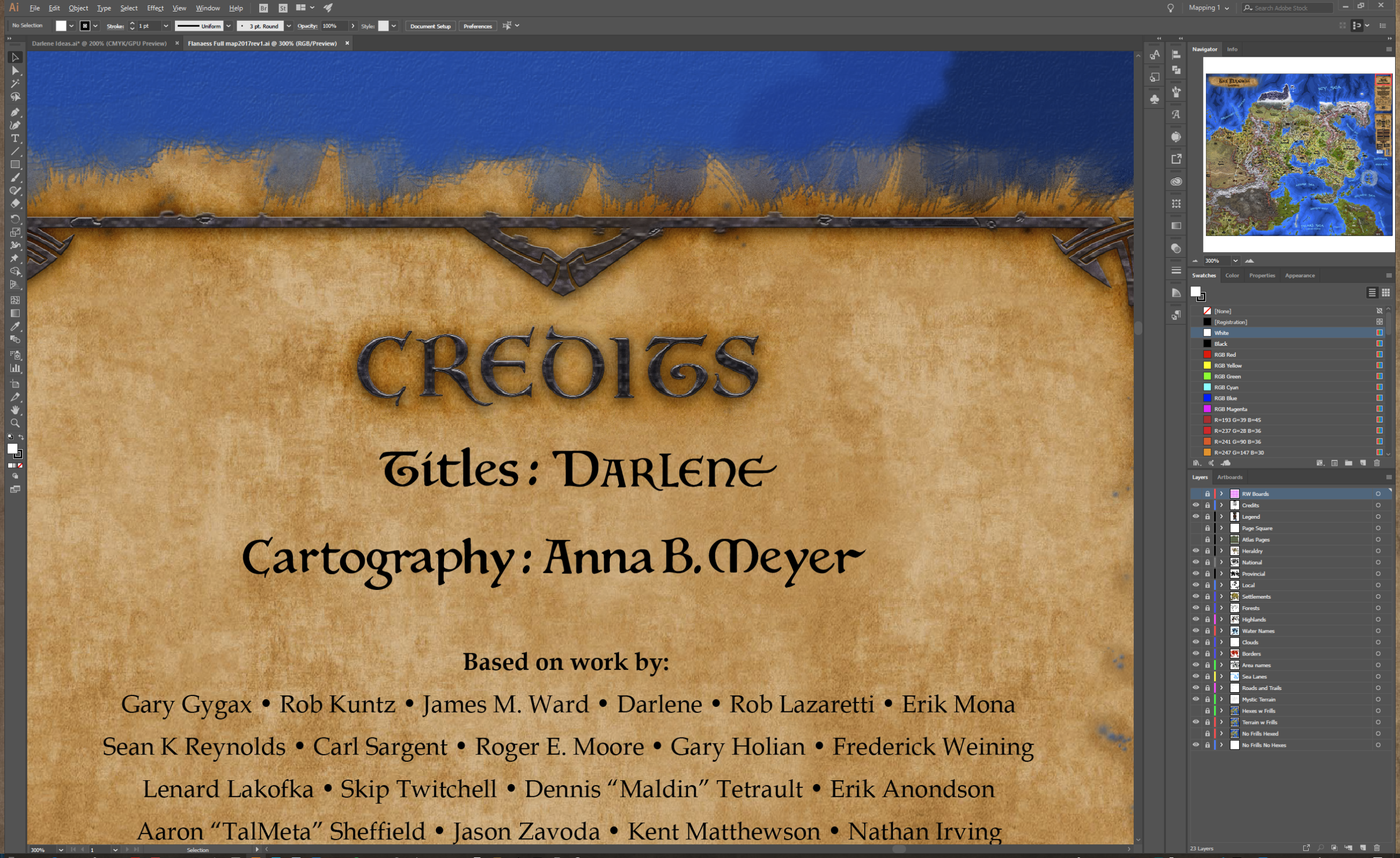
Darlene have graciously accepted to be a Guest Creator on my Patreon, her artistic talent and expertise will bring some unique possibilities to work on projects loved by Greyhawk fans. This will be a great addition to the other Greyhawk themed projects I'm planning later this year. If my Patreon continues to be this successful I plan to dedicate a whole year to Patreon starting this fall and concentrate on my passion with the Flanaess and its surroundings as a way to both recharge my creative ability and to give back to all of you who are supporting me.

Thank you again for all your support!
Now we need to figure out who lives on these islands, and especially where and in wt do they live. I have tried to come up with some of this while working and here are some of my ideas:
Fishing villages, little trading town, inland fortress, farming community, a lighthouse or more of course, a temple to a god.
Now I want to hear your ideas!
Then I'll take my 10 or so favorites and create a Patreon Poll to determine the what should go on the final map.
Here are the links to larger versions of the Island preview images:
Top down:
https://www.dropbox.com/s/axd49yoy2qa4e0e/Island%20top%20down%201.jpg?dl=0
Isometric:
https://www.dropbox.com/s/mjmwiti2c6y8npj/Island%20Vue%20isometric%201.jpg?dl=0


 Unlock with Patreon