Made a set of terrain only maps, both the standard terrain texture and a the latest parchment version. They come in both 12 mile hexed and non hexed versions.
You can get them here:
http://bit.ly/GH-FlanaessTerrain-JPG-2019REV1
http://bit.ly/GH-FlanaessTerrain-HEX-JPG-2019REV1
http://bit.ly/GH-FlanaessTerrain-Parchment1-JPG-2019REV1
http://bit.ly/GH-FlanaessTerrain-Parchment1-HEX-JPG-2019REV1
Adobe have updated Illustrator, and now for the first time you can properly export PSD files of individual layers and retain transparency. This is a huge time saver and means that I can save individual layers in 250 dpi resolution. There seems to be a 30,000 px export limit on all formats except PNG which can take forever to compile, so expect large PNG export to take a VERY LONG time. With PSD exports there are very little compression involved which mean faster exports but huge files.
For me I prefer things to go faster and invest a bit more in storage, but your preferences might vary. High on my investment list some sort of SSD based storage for my Dropbox and OneDrive, it will be expensive but save me lots of time in less wait for things to open or save. I have SSD's for system and scratch drives, 3TB all in all, but for storage I need at least 6TB more. Prices are coming down: Samsung SSD 860 EVO 2TB M.2 SATA Internal SSD for $319! Seems like I need to start to read reviews on PCIe M.2 adapter cards...
If you want to change to content of the map the easiest way is to grab the Illustrator file and edit it to your liking you can get it here:
http://bit.ly/GH-FlanaessFull598CY-AI-2019REV1
The PSD format (Photoshop's standard file format) only supports file sizes up to 2GB, and for my Flanaess map in layers that is far from enough, since it weighs in at 8.36GB. Thankfully Adobe has created the PSB file format (Large Document Format) that support much larger files, both in bite- and pixel size.
The 598 CY Flanaess PSB map file has over 40 layers, and I added a few masks as well to make it more useful. You can grab it here:
http://bit.ly/GH-FlanaessFull598CY-PSB-2019REV1
This file and the Water- and Ocean Masks are the ingredients you need to start styling the map to create a look you like!
By using Photoshops built in filters, blend modes you can create something really cool and varied results without having to do too much work. Below is a version I created in about 6 hours of playing around

You can get the full JPG map here:
http://bit.ly/GH-FlanaessFull598CY-Parchment1-JPG-2019REV1
Here is the PSB file I used to create this map version (a warning, it is 11.6GB):
https://www.dropbox.com/s/sdlwhvekgyknouk/Flanaess%20Full%20Map%20598%20CY%20-%202019%20Edition%20REV1_Handout%20Example-1.psb?dl=0
Here you can see the blend modes I used, and get the parchment layer I added. Test to play around with the filters and see what you can come up with.
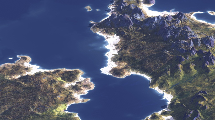
Vue, that is one of the tools I use to render 3D images with, have finally included isometric camera projection. Been waiting for a proper 3D rendering tool that could do terrains the way I need and also have the Isometric camera projection. This is one of the easiest ways to show as 3D landscape as a 2D image and get a good sense of the topography, even over a large area.
Couldn't resist the temptation to try it out, and here are my first results.

The resolution is about 100 ft per pixel and my initial reaction is that this is very promising!
It renders very quickly and it looks good, and gives a good sense of the landscape.
Considering that these images are a first test that only uses a highmap and a simple texture as material, and still comes across as OK, means that this has great potential. With a proper material setup and forest material, PBR and specular map, bumps etc this can hopefully look really good.
It is also easy to merge rendered bits to cover a large area, which makes it something to look into for future setting maps. It will be a good variat in the mapping bag of tricks.
A detailed blog post will come when I know a bit more of what I'm doing and have read the manual!
My next convention will be Gamehole Con in Madison Wisconsin, and on Thursday October the 31st Alyssa Faden and me will have a seminar together.
It will be an AMA session that I'm sure will be interesting for Fantasy Cartography enthusiasts. There are still 70 tickets available as I'm posting this.
Here is a link for those who are interested in coming: https://www.gameholecon.com/events/event/7950
I hope to see many of you there!
After a lot of trouble getting a proper room and with a far from good projector the seminar was off to a good start with a bit over 60 attendees.
The first part of the seminar was an overview of my work from the Flanaess to the latest finished commission for Gryffonlore Games.

I explained how the Creative Commons -BY - NC -SA license basics and why I choose it.

With a couple of slides I presented the various versions of the Flanaess map.


Then I presented an overview of the other maps I've created and first out where the world of Midgard for Kobold Press.

Here is a sneak peak on the new updated version of Southlands coming very soon.

and Midgard.

My only published city map, Per-Bastet in Southlands.

and a first look at the new political map of Midgard - Southlands. Note that this is a work in progress and not the final version, will work on a revision just after posting this. But it gives a good hint at what it will look like.

My latest published commissioned map, the Fallen Barony of Wailmoor for Gryffonlore Games.

I did a series of encounter maps for Zombie Sky Press for a Faerie book, my only published encounter maps.

Here is a sample of a map I did for Alex Kammer. It has a lot of snow cover and cold area which was a first for my new WM based technique.

This is a map I did for Hans Cummings, and originally it was in full color. This is an example of the fact that in my job you have to be ready to change formats, colors and sized to suit various forms of publishing, so a firm grasp of computer imaging is a must.

Sometimes you have to work fast and cut corners. Here is a map that I had a week to finish for Lamentations of the Flame Princess. Not pretty but it was needed in a hurry for a horror themed project. Everything included the symbols had to be made from scratch with very little references.

Next was a section where I expanded a bit upon my thoughts around fantasy map design.

The first is the base purpose of the map and the Information - Inspiration balance. How cool does map need to be vs how much information should be included. I made the examples with the old "blue style" dungeon maps that became a phenomenon despite the fact that they are very low on the inspiration factor.
The example below are maps of a zoo in Sweden seen on Google maps vs their own map to try and inspire visitors to see the whole park.

Next is a series of slides that looks at the area of Greyhawk mapped in various ways. First the proper classical fantasy way by Darlene.

and here is what the same area would look like in an modern road atlas:

and in a version for use by airline pilots:

and finally my own take on the same area:

We had a fair bit of discussion on symbols and what could be useful for a DM to have on a map for DM's to reference during (and in between) games. Below is a sample of the symbols I use on my Flanaess maps:

Then I showed the same area in other map variants more to be used as in game props. First a canvas map that could represent a top end map belonging to wealthy lords.

The nest is a version that could symbolize a map in a for the characters strange language, or maybe they are illiterate.

and a player version in parchment style:

and here is a player reference map that can be used with fog of war to show and track overland movement with hexes. I talked a bit about the odd 30 mile hexes on the Darlene map version the now more common 12 mile hex seen here.

and the same map without hexes.

Now onto the section on how I create the 3D terrain for my maps. The image below shows a sample of the many different types of data that goes into the process.

I kicked off this section talking about which tools I use and showed this slide with my main tools.

and here is the map of the Kingdom of Lothmar for Gryffonlore Games that I will use as a reference is the following slides.

The whole process starts with visual programming in World Machine.

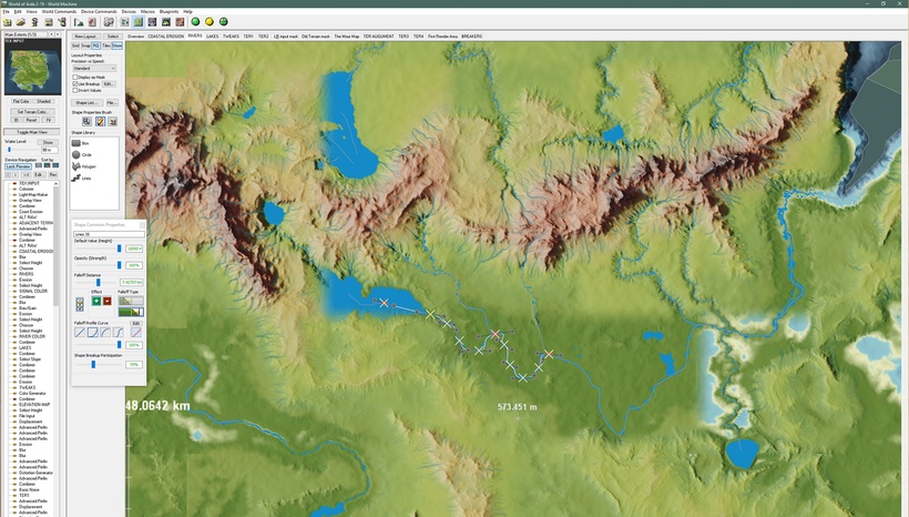
and then the actual terrain building in World Machine using the layout tool.

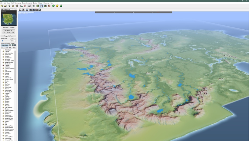
and you can see a primitive preview to get a basic state of things.

after terrain creation is done its time to export things from World Machine into TIFF, JPG and PNG files. First is the grey-scale image that stores the elevation data in the form of a height map.

a basic set of textures. In this case only a single VERY rudimentary texture. Most projects can have a dozen or more textures, but they all need to be touched up and finished in Photoshop later.

a key component is the shading!

Masks makes editing a lot quicker and easier. Comes in the form of black and white or gray-scale images. Here in the form of a Water Mask.

and a grey-scale Slope mask.

an elevation colored image makes editing easier as well.

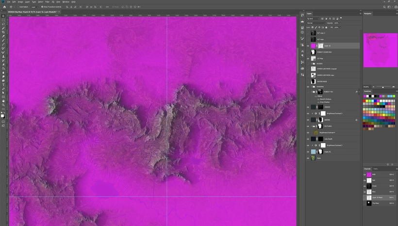
and once you have it in Photoshop you can start the often hard work of editing adding things like vegetation and bare rock. Below is a screen shot to show the myriad of layers that you play around with during editing.

This shows how you can use an elevation mask. I often use strong signal colors to better see what is editable or not.

by combining multiple masks you can quickly and precisely get things the way you want them.

When you're done editing you can merge the myriad of layers into a more reasonable number for the final image. Here they come from bottom to top. First the base water color which in this case is a simple blue, but by varying this you can make different water get a more natural varied feel to them.

Next is the ground texture. This sample is not finished but close enough to show the process.

add water depth..

snow cover where appropriate..

and forest cover...

and cover it with the shading, with the blend mode set to multiply to get the right effect.

and add an adjustment layer to get the light level back again and the top down terrain is ready for symbols..

Here is a look at it in 3D:


and to show what a finished area can look like I showed the Islands I did as my second Patreon project.

The next section was some teasers of what is coming (tm!)..


and what most of you as well as most of the seminar audience at Gen Con are waiting for....

My Greyhawk projects that will be a part of my Patreon. First out Flanaess 576 CY...

and Lendore Isles...

and next year Ratik...

Then a couple of Projects that we have to decide the priority of here:


and a final slide on how to help me and follow my work!

I just got back home from Gen Con, and make a quick post to thank all of you who came to say hi at the Lone Wolf Development booth or came to the Seminar. You made it a fantastic experience!
Working on a seminar report with slides and a presentation of the projects mentioned at the seminar, plus a couple of projects that are still secret. This will come later today and then throughout the week.
This week's episode of the Legends & Lore Show will also be about Gen Con, so please tune in tomorrow evening @8pm EST.
